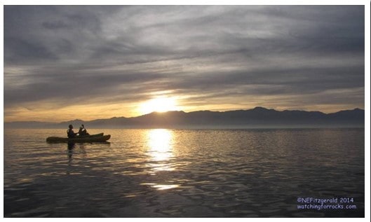
During my “2014 Winter SoCal Adventure,” I took a leisurely winter solstice kayak tour in 75°F southern California sunshine wearing sandals and a Santa hat. Ten days later, at home in cloud–shrouded southern Utah, it is nearly 50°F colder and I am wearing sweatpants and two pairs of socks. A winter Pacific storm is blustering its way across the western U.S., so it looks like I will be trading that kayak and sandals for some cross-country skis and insulated boots.
 |
| Feet on the Salton Sea – Winter Solstice 2014 |
I had read about the Salton Sea over the years, and most of what I read was not good. It is a dismal, smelly desert wasteland. All the fish are dead because there is so much agricultural waste flowing and blowing in, and there is such a high evaporation rate, that nothing can survive. The detritus of mid–20th century human endeavor litters the shoreline. It used to be a fun vacation spot but has deteriorated over the decades. It is a “fake” sea, anyway, so why go there?
Try telling that to the millions of birds that use the Salton Sea as a migration stopover or year–round habitat. See what they say!
 |
| Great egret and unidentified gulls |
We go on vacation when we have the time, which in my case turned out to be around the time of the winter solstice. I decided to visit this “accidental sea,” kayak with a Park ranger, watch some of those birds, and find out why the sea even exists at all.

What is the Salton Sea, anyway?
The Salton Trough, where the Sea is found, is a rift valley where the Earth’s crust is stretching and sinking along the boundary between the North American and Pacific plates. I had long ago learned that the Sea is located at the southernmost point of the San Andreas Fault, a transform boundary. But what I did not know until a week or so ago is that it is also located at the northern termination of the East Pacific Rise, a divergent boundary. The Salton Trough is a landlocked extension of the Gulf of California.
 |
| Image courtesy of earthobservatory.nasa.gov |
A remnant of a larger prehistoric Lake Cahuilla, the Salton Sea is California’s largest lake. Like the Great Salt Lake in Utah, it is a closed basin, where water is lost to either evaporation or seepage into the ground. There are no surface rivers or streams draining the Sea to transport its waters away to the ocean.
 |
| Great egret and white pelican on the edge of the Salton Sea |
For at least the past three million years, the Colorado River has scoured a passageway from high in the Rocky Mountains across the southwestern U.S. The river has changed course constantly, meandering randomly and dumping large amounts of sediment into the Gulf of California (known as the Sea of Cortez in Mexico) where it formed a fan–shaped delta. If the river happened to course north or west, water would flow into the Salton Basin and a large freshwater lake would come into existence. If the river shifted course and flowed south, the lake would become abandoned, succumb to evaporation, and ultimately vanish. Over the millennia, Lake Cahuilla would alternately exist or disappear owing to the whims of a capricious river. Additionally, over time the delta built up so much sediment that the Sea became cut off from the northern stretches of the Gulf.
 |
| Kayak with a ranger! |
 |
| Setting out to sea |
Lake Cahuilla is believed to have been six times the size of its latest incarnation, the Salton Sea. However, when 16th century Spanish explorers first entered the area they found a dry lakebed. Indian legends, though, told of the existence of a large body of water in the valley to the west.
 |
| Winter Solstice kayak on the Sea |
By 1903 over 100,000 acres were being irrigated with Colorado River water in what was being called “The Imperial Valley.” Two years later, floodwaters of the river breached irrigation canal works. For 18 months, until the breach was repaired, water flowed relentlessly into the basin and so created the modern Salton Sea. Then and now, agriculture is possible in the Imperial and Coachella valleys of southeastern California because of the massive thicknesses of silt that accumulated in the prehistoric lakebed.
 |
| Appreciating the little things – a calm sea and no headwind |
The Salton Sea is an important wetland along the Pacific Flyway. Nearly half of the 900 species of North American birds have been seen at the Salton Sea National Wildlife Refuge, more than any other location in the country except for the gulf coast of Texas. Once upon a time the Colorado River delta offered critical habitat for birds when the Salton Sea evaporated. Now that the delta no longer exists in Mexico, it is vital that the Salton Sea ecosystem be maintained.
 |
| Great egret on takeoff |
Without water runoff from irrigated lands flowing into the basin, the Sea could not exist. However, pesticides in the water, increasing salinity, a high evaporation rate, and remoteness all contribute to the declining health of this complex and fragile environment. There are many issues concerning the future viability of the Salton Sea. Up until a few weeks ago I had no idea of its biological importance, no concept of its austere beauty. I am glad I went.
 |


