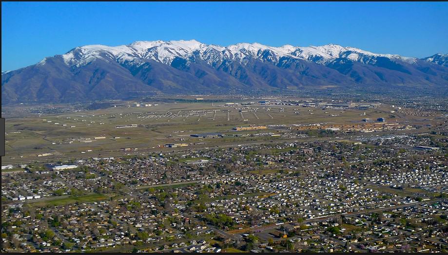
The summer begins, as it often does, with a hike. The summer ends, as it often does, with another hike. Looking back, I realize that two unique Wasatch Mountain trails have become the bookends of my summer.
 |
| American Fork Canyon in the southern Wasatch Range |
Back in May of 2014, while en route to my seasonal rangering job at Yellowstone, I stumble upon the magnificently stupendous Z-fold of Ogden Canyon in the northern Wasatch Mountains. Three and a half months later finds me at the end of my rangering season (no, I was not fired!) searching diligently for some intriguing geological wonder to explore on my way home, seeking out rocks that I have never visited during the 20 years I’ve lived in Utah. There would be no lollygagging along the way, though, since I would need to get home to my part–time teaching job that had already started without me. It would have to be a quick stopover, short and sweet.
Where, oh, where shall I go?
After much waffling, dithering, and flip–flopping I finally decide to take the ranger–led tour through Timpanogos Cave, a short drive up American Fork Canyon about an hour or so south of Salt Lake City. It wouldn’t be that far out of my way, it would use up half a day at most, and I could stay in a lovely motel while avoiding the bleak prospect of sleeping on the ground inside a sleeping bag and tent that I would inevitably have to excavate from within the overstuffed cavern of my car.
 |
| The north wall of American Fork canyon – home of undiscovered caves? |
The Cave system is a unit of the National Park Service and is located about halfway up the southern wall of American Fork Canyon. If you happen to be a mountain goat, you could hop or skip along a nearby ridgeline and then jump up to the 11,750–foot peak of Mount Timpanogos in the southern Wasatch.
I decide against the goat route and choose the more civilized paved trail (you really have to admire those CCC boys), which, in case you have been wondering, is not without its own thrills. Whether you measure your distances in feet or meters, miles or kilometers, this is one steep pathway. I would be walking “up–section” from the parking lot to the cave, ascending 1,065 feet in 1.5 miles, through geologic time from older into younger rocks.
 |
| The civilized route to Timpanogos Caves. |
According to my favorite reference for this sort of thing, American Fork Canyon displays a thick sequence of rocks deposited as gravel, sand, mud, glacial till and limey ooze between Late Precambrian and Late Paleozoic times (≈ 620–256 million years ago). The Timpanogos Cave system would have begun around 340 million years ago in a shallow sea, in sediments deposited as the Deseret Limestone.
Glaciers advanced and retreated during these several hundred million years. Mountains uplifted and subsequently eroded away, the seas came in and the seas went out, alternately submerging and exposing the continent along the western margin of an ancient North America.
Later during the Sevier orogeny, a major compressional mountain building event that began around 140 million years ago and lasted for some 80 million years, thrust faulting and folding occurred in the uplifted mountains that would one day become the Wasatch Range. It was on bedding surfaces and within the faults and fractures created during this geologically tortuous time that the Timpanogos Cave system most likely developed.
About 40 million years ago extensional faulting commenced, culminating 23 million years later with the uplift of the Wasatch Range during Basin and Range extension. Downcutting of deep stream channels accompanied this uplift, and as the American Fork River carved its canyon deeper and deeper into the lithified gravel, sand, mud, and limey ooze, the cave system became isolated, higher but not drier up on the canyon wall.
Let me get this straight. How do caves happen?
When rainwater (H2O) falls to the ground, it accumulates small amounts of carbon dioxide (CO2) from the atmosphere and from the layers of soil it eventually passes through. The H2O and CO2 combine to form carbonic acid (H2CO3). This acidic solution dissociates into bicarbonate (HCO3–) ions and hydrogen (H+) ions. The hydrogen ions slowly dissolve the limestone rock into larger and larger cave passages.
 |
| Calcite precipitates out of solution, forming stalactites. |
In caves filled with air, the carbon dioxide will separate out from the water. At this point the water can no longer retain any calcite minerals that had dissolved, and the calcite will precipitate out. Over time, these minerals build up on the cave walls to form all sorts of textured deposits that are so fascinating to glimpse – stalactites, stalagmites, columns, helictites, frostwork, drapery or cave bacon, flowstone, and much more.
Watching for falling rocks
The Park Service recommends taking an hour and a half to hike to the cave entrance. At the rate I walk (not much faster than glacial speed) plus stops for photo ops, it takes me practically the entire allotted time. Anyway, I am in no mood to rush through this cool, sunny September Wasatch morning. The sweltering heat of southern Utah will just have to wait a few more hours for my arrival.
A minute or two after I start up the trail I notice this sign.
 |
| One of many signs along the trail. |
Being the insightful individual that I am, it does not take long to figure out that these words of caution must have something to do with this nearby assortment of objects artfully arranged by the forces of gravity.
 |
| One of many rockfalls along the trail. |
Just in case you might be inclined to disregard the warnings, the trail crew leaves this boulder languishing in place along the trail.
 |
| I bet I know where THIS came from! |
A little further on we are given these words of wisdom.

This next sign almost makes me reconsider the whole adventure. Regardless, I press onward and upward, afraid to look up for fear of what might be on its way down.
 |
| Watch for falling rock, indeed. |
Other less intimidating signs point out the different geologic formations as the trail moves up–section, from older to younger rocks. The sign for the 620–million year old quartzite, grit, conglomerate, and shale of the Mutual Formation, which crops out at the bottom of the canyon, is nowhere to be seen, most likely crushed into oblivion by the reason for its existence. Another plaque tells of the 543–million year old Tintic Quartzite, whose sediments were laid down in a subsiding basin beneath an eastward advancing sea.
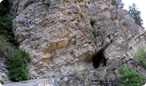 |
| Tilted beds of the Tintic Quartzite. Everything is tilted around these parts. |
Rocks of the Ophir Shale, Maxfield Limestone, and Fitchville Dolomite each offer tantalizing clues to landscapes so different from what we see today in the Wasatch Mountains.
 |
| The Fitchville Dolomite was deposited on the thinning eastern edge of a shallow basin |
If there was a sign naming this next rock I did not see it. I’ll go out on a limb here (or perhaps I should go out on an outcrop) and say it is the 342–million year old Gardison Limestone. My favorite reference for this sort of thing describes this formation as having “thin–bedded, blue–gray limestone with silty partings.” The brown layers would be the silty partings.
 |
| Blue-gray limestone is interlayered with brown silt |
A herd of a lone turtle, I follow the trail as it switchbacks up the canyon wall, pausing for breath and views, moving along with a purpose where the signs and red or yellow stripes indicate it is prudent to do so.
 |
| Can you see the thrust fault in the gray rocks? |
The approach to the caves announces one last chance.

Cave entrance achieved!
 |
| Made it to the cave entrance with oxygen to spare. |
Once inside the cave I quickly determine that I should have ditched the backpack in my car and just carried water and my camera. Space constraints are not so bad in the man–made tunnels that connect the three caves in the system. The caves themselves are another story, though. You find yourself slithering through those narrow passageways in various degrees of gracefulness in an exercise referred to as “cave yoga.” You want to avoid contaminating fragile cave formations with microscopic clothing lint and icky body oils, and it is not an easy task.
 |
| Not much room here, folks. |
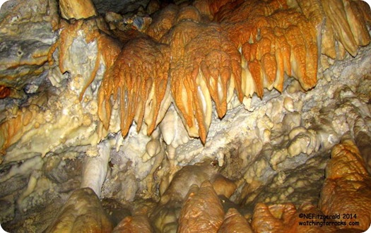 |
| Iron oxides? Also found in the cave are manganese, nickel, zinc, barium, and other trace metals. |
 |
| This is a great place to turn out the lights. |
The group lumbers on through fractures and faults, gazing in wonder and amazement. Sadly, history tells us that souvenir hunters broke off many formations, thinking they could make some quick cash from the “valuable” rocks. However this did not prove to be the case and they ultimately ended up destroying what only has value when left alone. Thankfully, most of the scavenging took place closer to the entrance.
 |
| Coraloids |
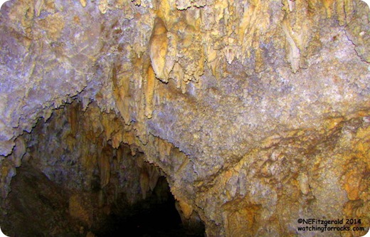 |
| Stalactites |
 |
| Helictites |
Subdued electric lighting allows the visitor to see the formations which otherwise would be in absolute darkness. Ranger Cassidy spins a good interpretive story and holds our attention for the full hour. In fact, at one point she flips a switch and for a moment we are immersed in that absolute darkness (they always do that on cave tours!). I do not take any pictures at this point because, well, it is really dark.
One of the most famous formations in the cave system is called the Heart of Timpanogos, estimated to weight around two tons. How they calculate that I have no idea. Somehow I don’t think they broke it off, put it on a scale, and then glued it back on to the ceiling. But you never know.
 |
| The Heart of Timpanogos |
Assisted by the wonders of electricity, Ranger Cassidy points out cave bacon, soda straws, and helictites.
 |
| Cassidy and her cave bacon. |
 |
| Soda straws and a bunch of other stuff drips from the ceiling. |
 |
| Soda straws and stalagmites |
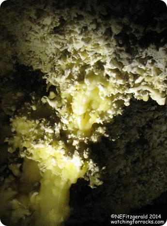
It is right about here that the teenage boy behind me (and his father!) begins to giggle and describe the formations as “cave snot.” After a brief moment of eyeball rolling on my part (Oh, puh–leeze! Really?) I realize I agree with their juvenile interpretation.
 |
| Cave snot? Or not? You be the judge. |
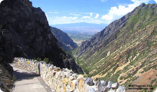
Soon we are out in the daylight once more. I know I am not a caver, or a spelunker, or whatever people are called who like caves. I like sky over my head. But I do enjoy an occasional cave tour, especially the part when they turn out the lights. Several people today have taken the tour many times since it is located within easy access to cities along the Wasatch Front. For me, however, it is a unique opportunity to experience something completely new. On the way down I take time to enjoy the view, gravity helping to careen me down the mountain faster than I thought my knees could ever careen.
 |

