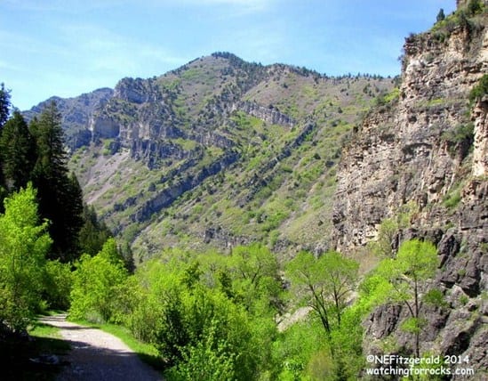
My original plan was to spend a few mid–May days at Antelope Island state park in the Great Salt Lake and hike Frary Peak, the highest peak on the biggest island in the largest saltwater lake in the western hemisphere. However, cold windy weather and a waffling state of mind led me to a change of plans. This change turned out to be fortuitous, since I would have most likely been eaten alive by Antelope Island’s famous biting gnats. Also, I might have missed this jaw–dropping Z fold in Ogden Canyon.
 |
| See the Z across the canyon! |
In the end, camping among the bugs morphed into a cushy condo stay in Wolf Creek near Pineview reservoir, a few miles east of Ogden, Utah. I still harbored thoughts of hiking Frary Peak, though. It was not that far of a drive for a day hike.
However, when I arrived at Wolf Creek, I said to myself “Self! I am not leaving! It’s just too beautiful here!” and asked the clerk at the condo desk if she had any recommendations for a day hike nearby. She suggested the popular Wheeler Creek trail at the head of Ogden Canyon. The metamorphic rocks of Antelope Island would just have to wait.
And so the next morning, after sitting through a 90–minute sales presentation and walking away with a $75 gift card (some people will do darn near anything for a few bucks, won’t they?) I drove the few short miles to the trailhead.
 |
| The finger points the way to a counterclockwise loop. |
I moseyed over to the trail kiosk and chatted up two friendly women and their white fluffy dog that was wrapped in a Spiderman t–shirt. “We come up from Ogden and love this trail!” they all gushed. I had thought about doing a loop and asked them about the distance. They said it was “no more than around ten miles” and that it probably shouldn’t take more than “about two hours.”
Oh, really? Ten miles in two hours? On which planet?
I gave myself four to five hours just to be safe and asked everyone I passed the same question as I traipsed my counterclockwise route: Can I get to where I think I’m going this way?
 |
| I’m thinking limestone. |
Sadly, I hadn’t thought to look up a geologic road log beforehand so I was hiking by the seat of my geologic pants. I don’t know much about the specifics of Ogden Canyon, but from what I do know I figured these outcrops must be mostly Paleozoic shallow marine limestones, deposited somewhere between 540 and 250 million years ago, when Utah was near the equator on the passive continental margin of an ancient North America.
 |
| A sign to a bridge |
I lost count of how many bridges I crossed on this well–maintained trail.
 |
| A bridge in the forest |
Eventually the trees opened up to a grand meadow and the peaks of Snowbasin. I had to turn around to view the view I would have been viewing had I chosen to hike clockwise. It was worth the effort, though. Soon I met my friendly dog people coming back and they said I was on the right trail. Yay, me!
 |
| I had to turn around to see the peaks of Snowbasin. |
 |
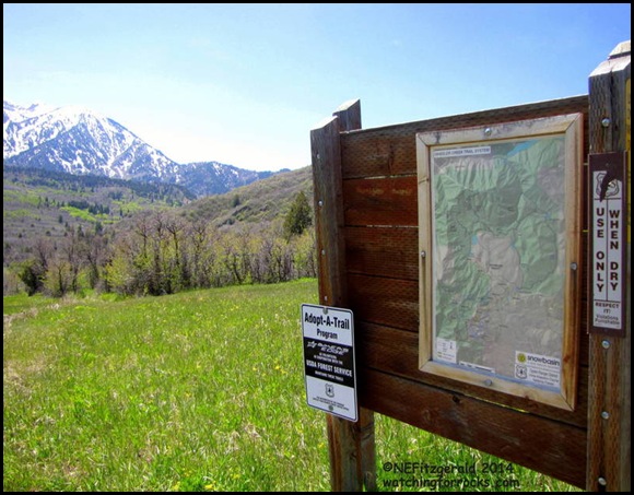
| A map! Just point me in the direction I’m going. |
The Art Nord segment was the final leg of my solo hike, along an old roadway that descends along the creek and through the weathered limestone outcrops of Wheeler Canyon. Along the way, I made a cursory search for fossils but never did see any.
 |
| Back in the limestone on the Art Nord trail |
New shoes and the nagging start of a blister meant that I was happy to be nearing my car. As I rounded a corner the massive Z fold came in to view from across the canyon, and I simply had to stop and stare. After I got back to the condo, eased my tender tootsies out of my new shoes, and poured myself a well–deserved glass of wine, I found this road log guide from Weber State University in Ogden.
The rocks in this fold are of the Mississippian geologic period, around 330 million years old. But the Z is nowhere near that old. Around 230 million years after deposition of these sediments, during the Sevier Orogeny, a compressional event occurred called the Willard Thrust that brought about the shortening, shearing, faulting, and folding of these deeply buried rocks. Enter more geologic time and the entire structure became exposed along the cliffs of Ogden Canyon.
It’s too bad I did not know about this road log before my hike. Apparently, the trail crosses the Willard Thrust after about 1.5 miles, just as it enters the Snowbasin area. I was on top of it and did not even realize it. I had hiked steadily, starting at noon and returning to my car at 3:30. With an average rate of speed of two miles per hours, I figured my loop distance was around 7 miles. Not quite the ten miles in two hours those women and their dog had calculated, but I did stop to ponder that Z fold. I wonder if they ever even noticed it.


