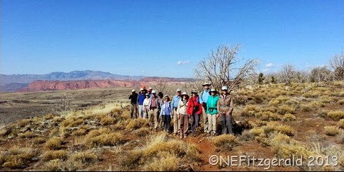
Here is post number three in my series “Twelve months in thirteen days.”
I have always wanted to do this. The time is now! This means posting at least one image each day for the rest of the year of people, places, and rocks I have gotten to know better in each month of 2013.
 |
| These happy hikers sure asked a lot of questions! |
Last March I led a group of happy hikers around Broken Mesa in the Red Cliffs Desert Reserve and wrote about our adventure here. Views were 360° in all directions.
We looked to the west!
 |
| View from the broken edge of Broken Mesa |
We looked to the north!
 |
| Pine Valley Mountain from Broken Mesa |
We wandered around looking for a not–so–rocky place to sit and have lunch!
 |
| Wandering hikers seeking to re-fuel |
After a rocky re–fueling we stumbled across this survey marker, somewhere in the middle of the mesa.

From Wikipedia: “The General Land Office (GLO) was an independent agency of the United States government responsible for public domain lands in the United States. It was created in 1812 to take over functions previously conducted by the United States Department of the Treasury. Starting with the passage of The Land Ordinance of 1785, which created the Public Land Survey System, the Treasury Department had already overseen the survey of the “Northwest Territory” including what is now Ohio [FYI: Utah was made a state in 1896. It is nowhere near Ohio].
Placed into the Department of the Interior when that department was formed in 1849, it merged with the United States Grazing Service (established in 1934) to become the Bureau of Land Management on July 16, 1946.”
How this 1909 survey marker survived destruction by herds of clueless cows will forever remain a mystery.


