High on the tilted western edge of the Colorado Plateau in southern Utah lays a hidden gem of the National Park system. A tiny park as western parks go, Cedar Breaks National Monument is often overshadowed by the more famous Bryce Canyon to the east. Both parks can be found in what is called the High Plateaus transition zone between the Basin & Range province to the west and the Colorado Plateau province to the east. Both parks share a similar geologic history with dramatic exposures of 50–million–year–old lake bed and river sediments. Both parks are eroding into natural amphitheaters that display fantastically shaped chimneys, hoodoos, pinnacles, turrets, towers, cliffs, and fins in every brilliant rainbow shade of red, pink, purple, orange, gray, tan, and white.
But there is one important distinction regarding Cedar Breaks. In the summer of 2009, at over 10,000 feet above sea level and with a new geology degree in my hot little hand, I started my seasonal career as an interpretive ranger with the National Park Service. A few weeks ago I returned for my annual autumn visit, knowing it is definitely worth driving 75 miles one way to hike four miles.
 |
| My first NPS job – I should be wearing the flat hat when I’m outside! |
Walk the Spectra Point trail that runs from the visitor center along the rim of the amphitheater and you will be standing on a drainage divide. Look carefully and you might notice that any water falling as snow or rain on this high plateau edge has the potential to drain in opposite directions off this eastward–tilting plateau.
 |
| Left or East is Colorado Plateau – Right or West is Great Basin |
When rain or snow falls and drains to the east out of the amphitheater rim it falls toward the Colorado Plateau. Over time and space this drop or flake traverses many rivulets and creeks and one day drains into the Colorado River.
 |
| Left or West is Great Basin – Right or East is Colorado Plateau |
When rain or snow falls west into the amphitheater it drains towards the Great Basin. Here, it ultimately evaporates or simply disappears underground – there is no surface drainage to any sea in this vast lowland desert of southwestern Utah and eastern Nevada.
 |
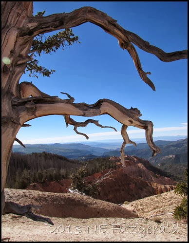
| Western distances through ancient bristlecone pines |
Have you ever left a garden hose running in some dirt, only to come back later and find a small mud canyon has appeared under the hose and destroyed your carefully dug flower bed? “Headward erosion” is the name of the geologic game on this plateau edge and also in your garden. Erosion occurs in the direction that water originates, in this case on the rim of the amphitheater. Inch by inch, grain by grain, and boulder by boulder, headward erosion is eating away at this edge of the Colorado Plateau and exposing the spectacular rock formations of Cedar Breaks.
But, what about these spectacular rock formations? What happened to that 50 million year old lake? How did that get there?
 |


