The hike was called “Little Creek to a T.” And although I quickly learned we were on Little Creek Mountain, it never was clear to me what exactly a T had to do with anything.
I looked for that T in six miles of dirt road.
I looked for that T in eight miles of trail.
 |
| Edge of the trail |
We first gathered in a clearing of juniper trees, at some ruins of a pit house perhaps a thousand years old, but no one is really sure of the age. Ancestral Pueblo people once lived and died on these high mesas, cultivating their corn, beans, and squash, and leaving us faint whispers of their fragile existence.
 |
| Pit house ruins |
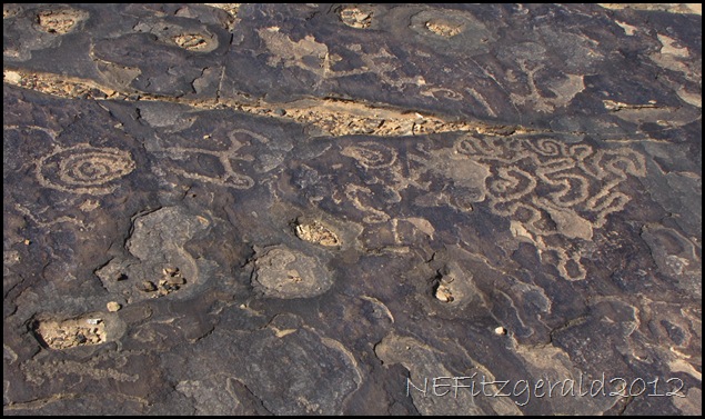
In the clearing there was only flat sandstone bedrock on which these ancestral people could carve their petroglyphs. The gradual disappearance here of this rock art due to exposure to sun, wind, rain, and snow only serves to add to the mystery of who and why.
 |
| Petroglyphs on flat sandstone bedrock |
As I stood there snapping photos I got the distinct feeling that everyone had already disappeared into the trees. It is apparently my lot in this hiking life for me and my camera to always be at the rear of any group.
Hey wait for me!
The trail meandered in and out of dark green junipers, their branches tipped in a jigsaw puzzle of tiny scales. We tromped in the trees for a few miles, through occasional patches of snow melting to a muddy muck in the warming sunshine.
 |
| Coming out of the trees |
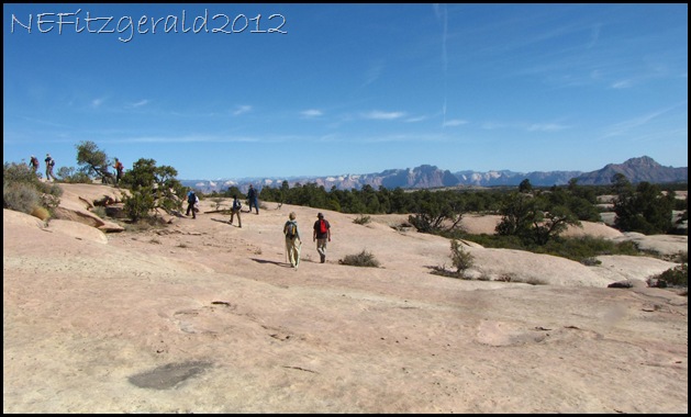
There was an audible “Ohhhh!” from the group when we came out of the trees and onto the seemingly barren sandstone slickrock. Silhouetted against a sapphire sky, stunted junipers grew in cracks and crevasses. Rain and snow melt filled pools in shallow depressions where the previous summer’s mud had cracked and dried. I contemplated pollywog survival rates in these desolate conditions.
 |
| Submerged mudcracks |
Of course my camera and I lagged farther behind.
Hey wait for me! Doesn’t anyone else take pictures out here?
 |
| Zion National Park in distance |
I thought about how easy it would be to get turned around up here. However, at these elevations the cliffs of Zion National Park and the peaks of Pine Valley Mountain are constant reference points. Most likely you would find your car eventually but might have to wander around for a few extra hours searching for it unless you had marked its location on a gps. Ask me. I know.
 |
| Rim with a view |
At last we reached the point where the trail appeared to drop off the edge of the fractured sandstone, passing from the rim to kiss the distant horizon. It was here that I found my elusive T, I thought. But the trail didn’t drop away. It coiled its way along the edge and so we followed it a bit further, to a lunch spot along the rim with views of nearly forever.
 |
| A view to forever |
On the way back out to the cars I took as many pictures as I had on the way in. This did not mean I was always the last hiker, however.
 |
| Walking the sandstone plank |
My requests for a somewhat slower speed and occasional rest break were met with a gracious pace adjustment by the hike leader. Actually, it was fine being at the rear while those fourteen sun–hatted hiker heads bobbled along in front of me.
Hey wait for me!
 |


