Thanksgiving 2011 has come and gone, and I’m slightly aghast that it has been nearly a week since I’ve posted anything on WATCH FOR ROCKS and even longer (here, here, here, and even here) since I wrote about my adventures getting to Canada. With nary a turkey giblet in sight during my favorite holiday I kept myself busy gobbling grilled swordfish and blackened mahi–mahi along with some of the best gumbo this side of the Atlantic. There were also several slices of key lime pie involved in this feasting. No wonder I was distracted.
Now it is really time to get back to what was, back in August 2005, originally billed as the “ALMOST ORGANIZED TOUR OF THE TATTERED REMNANTS OF THE SOUTHERN UTAH EARTH SCIENCE EXPEDITION.”
Sounds impressive, I know.
After our fourteen hour, rump numbing, 700 mile white–line marathon north through the mountains of central Idaho and western Montana, we realize that we are in serious need of a moment to decompress before our much anticipated entry into Canada. We choose to camp for two nights at the Whitefish, Montana KOA. It is close enough to our destination of the big bad Burgess Shale that we could probably swing a cat and it would land in Walcott Quarry. Our final day’s drive will be an easy breezy cruise along the Rocky Mountain Trench with a turn east onto the Trans Canada Highway at Golden, British Columbia.
A nice surprise is the breakfast included with our campground ticket, a Full Monty of eggs, bacon, hashbrowns, gravy, biscuits, fruit, coffee, and juices. After diligently grazing this morning buffet we realize the need for a lot more exercise than that provided by simply waddling back to our cars for a nap. So we decide to spend the day hiking, and consequently allow our moment of decompression to last the entire day.
 |
| Whitefish Lake MT from Big Mountain |
 |
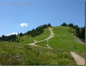
| Hiking Big Mountain MT |
 |
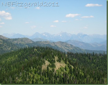
| Big Mountain MT trail with distant Glacier NP |
It’s a short distance to some inviting trails on nearby Big Mountain. We hatch a plan since JC and CO have skied here in winters past and are vaguely familiar with the area. It is the best of both worlds – we take our time hiking up (“lollygagging” would be a very appropriate description), have a bite of lunch and a beverage at the top, and glide our way down the mountain on the ski lift.
 |
| Lollygagging along the trail |
In 2005 I have little idea what the geology is around these particular parts. I have no geologic map and no roadside geology books to guide me. I’m flying blind, as it were. It is only several years later that I find out a bit more about the rocks of the Belt Supergroup.
 |
| image courtesy of Digital Geology of Idaho |
Belt Supergroup rocks, called the Purcell Supergroup in Canada, formed from sediments deposited in an immense depression or basin that once extended across western Montana, northern Idaho and into eastern Washington and Canada. This basin existed from around 1470 million years ago until around 1400 million years ago, and the sediments that filled it were deposited on crystalline rocks that are even older.
Rocks in Glacier National Park just to the east are also comprised of rocks of the Belt Supergroup. Also part of the picture, especially in Glacier, is what is known at the Lewis Overthrust, a 350–mile wide slab of brittle Belt rocks that, due to tectonic forces starting around 170 million years ago, was folded and ultimately fractured and then displaced over much younger rocks. The tectonic forces that caused the fracturing also caused this huge displaced slab of rock to move eastward possibly 40 miles toward the Great Plains (there is actually much debate about this distance).
 |
| Continental Divide peaks of Glacier NP from Big Mountain |
From Big Mountain we can clearly see the peaks of Glacier to the east, but any further understanding of its rocks will have to wait for a few years. For now, it’s a day of fun in the high–country sun of northwestern Montana.
 |
| Trail on Big Mountain |
 |
| Ski lift area on Big Mountain |
 |


