This really must stop. I have been procrastinating entirely too long and now is the perfect first-day-of-spring Sunday morning to get busy – gray overcast skies, blustery winds, temps in the 40s, a nice pile of reference books, and a carafe full of coffee. I just need to sit down, put pen to paper (or fingertips to keyboard, as it were) and figure out this whole “Salinian Block-Point Reyes” conundrum.
There are, as usual, so many questions. Where did the block allegedly come from? How long has it purportedly been on the move? Who are its suspected geologic relatives? Where does it think it’s going?
A brief review may be helpful here. To appreciate any sort of past (and, ultimately, future) movement of our Salinian Block, what do you think we should consider first?
Plate Tectonics, of course — nothing happens without it!
After the recent earthquakes and accompanying tsunami in Japan, the “Ring of Fire” has been in the news a great deal lately.
map_plate_tectonics_worldUSGS
Interestingly, the Pacific plate rotates around a point which is located south of Australia. However, unlike the mainly subduction action of the tectonic plates at Japan, transform or right-lateral strike-slip movement occurs along the 800-mile long San Andreas Fault (aka SAF). The average movement of the Pacific plate relative to the North American plate at the SAF is about two inches per year. Geologists believe that, over the past 20 or so million years since the SAF came into existence, the total horizontal displacement of the Pacific plate along the fault is around 350 miles. Geologically similar terranes on opposite sides of the SAF have been found hundreds of miles apart.
Point Reyes National Seashore, its headlands protruding ten miles out into the Pacific Ocean on the Pacific Plate, is today separated from the rest of Marin County, California and the North American plate by the San Andreas Fault. Apparently, sometime in the geologic past Point Reyes was not located here. It was somewhere else.
PointReyesGoogle
pic_sanandreasfault_285x285_3
So where did it come from? Where is it going? We can decipher some answers from the rocks of Point Reyes and others along the San Andreas Fault.
That’s the plan, anyway. As always, I must leave much information out – this is a blog, after all, not a dissertation. That said, I devote a lot of energy to making sure what information I do include is accurate. Enjoy the tectonic ride!
Around twenty-five to thirty million years ago, as the western edge of the Farallon plate was being subducted and consumed beneath the North American plate, a jagged eastern tip of the Pacific plate first touched North America at present-day Los Angeles and Santa Barbara. It was at this time that the transform boundary which would eventually become known as the San Andreas Fault came into existence.
Six million years ago, a terrane was moving northward along the west side of the San Andreas Fault on the Pacific plate. The actual origins of the sediments comprising this early terrane are obscure, an “unknown elsewhere” from probably hundreds of millions of years ago, lost in the pages of time. It appears, though, that as early as 110 million years ago molten rock from deep within the mantle had enveloped these sedimentary rocks.
In the fullness of geologic time this terrane would come to be known as the Salinian Block. It carried on its back the future sites of Salinas, Monterey, Big Sur, San Luis Obispo, Santa Barbara, Los Angeles, and San Diego. Today, a part of northern Salinia is the Point Reyes peninsula – the granites west of Tomales Bay and the San Andreas Fault. The San Francisco Bay Area is the northernmost place where our Salinian rocks occur.
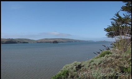
IMG_5752ViewTo SalinianBlock_ PointReyes Peninsula_Across TomalesBay_SAF
Plutonic rocks (the granites of the molten intrusion) of the Salinian Complex or Salinia Terrane occur only west of the SAF. They were formed in the “unknown elsewhere” of a subduction zone setting during Mesozoic plate collisions starting about 145 million years ago and lasting nearly 100 million years. These plutonic rocks formed deep in magma chambers as the subducting Farallon plate, predecessor of the Pacific plate on the west coast of North America, partially melted and slowly cooled underground.
The rocks of the Salinian Complex and thus Point Reyes are similar in silica composition to the granitic rocks found in the Sierra Nevada Mountains. Both are similarly 80-110 million years old.
IMG_5698Point Reyes
Evidence suggests that the granites of Point Reyes formed as a southern extension of the granitic Sierra Nevada Mountains, later to be separated from them by motion on the San Andreas Fault. The granites on the west side of Tomales Bay broke away from the southern Sierra Nevada and have traveled north along the fault at least 300 miles, one earthquake at a time.
IMG_5697Granite AtPointReyes
A comparison of the Point Reyes rocks with similar ones in the Santa Cruz Mountains and on the Monterey Peninsula to the south of San Francisco indicates that they are the same rocks and were once contiguous. The Point Reyes rocks have been offset about 90 miles by movement along the San Andreas and San Gregorio Faults; according to Evens, they sat docked next to the Monterey Peninsula from approximately 60 million to 15 million years ago.
The Salinian Block will one day move out to sea towards the northwest. The rocks of Point Reyes are only transient visitors, fleeting geologic travelers attached to the ephemeral Pacific plate as it moves past California on its journey towards some future Alaska.


