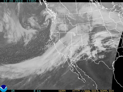
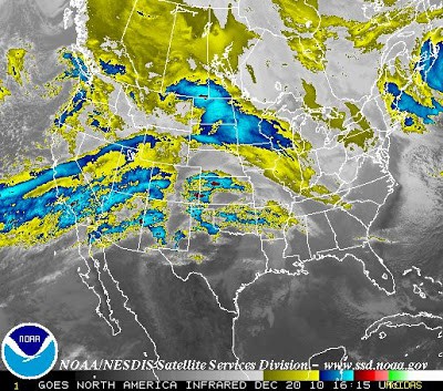
I just had to post these recent satellite weather images, courtesy of :


This massive system is known as the Pineapple Express and has its origins in the Hawaiian tropics (clever, huh?). It is full of warm, tropical moisture, can bring in a lot of rain on the west coast, and drop even more in the mountains – since the system is warm it raises the snow levels in the mountains, increasing run-off and melting snow at lower elevations and so adding more water to an already over-saturated situation. The result? Flooding and landslides. Although California usually gets most of the press, Utah is certainly not immune to similar effects – here is the most recent flash flood watch for the southwest part of the state including Zion National Park and the Virgin River:
Flash Flood Watch Remains In Effect Through Late Wednesday Night The Flash Flood Watch Continues For *A Portion Of Southern Utah Including The Following Areas South Central Utah And Utahs Dixie And Zion National Park. *Through Late Wednesday Night *Deep Moisture Will Continue To Spread Across Southwest Utah Through The First Half Of The Upcoming Week Resulting In An Extended Period Of Moderate To Heavy Rainfall Below 8000 feet. Rainfall Totals Of 3 To 5 Inches Are Expected Across The Lower Elevations Through Wednesday With 5 To 10 Inches Possible In The Mountains Below 8000 feet. *This Moderate To Heavy Rainfall May Lead To Flooding Along Small Streams Slot Canyons And Normally Dry Washes. Significant Rises Are Occurring On The Virgin And Santa Clara Rivers With Bankfull Or Flood Conditions Possible. Precautionary/Preparedness Actions A Flash Flood Watch Means That Conditions May Develop That Lead To Flash Flooding. Flash Flooding Is A Very Dangerous Situation. You Should Monitor Later Forecasts And Be Prepared To Take Action Should Flash Flood Warnings Be Issued.
So although it doesn’t appear that we will have a white Christmas, we can surely expect a soggy one.
Have a safe holiday week, especially if you are traveling!


