Imagine yourself on a vast featureless coastal plain, with geographic relief in every direction of only a few centimeters as far as the eye can see. It is an arid environment, with negligible rainfall for at least decades if not centuries at a time. High temperatures bring an attendant high rate of evaporation, and there is little vegetation to give ease to the eye from the bleak whiteness of the terrain (plus you forgot your sunglasses). Since it is a coastal plain, an occasional storm at sea might blow in to submerge the plain ever so slightly, barely covering your toes as you stand there, and bringing with it a thin deposit of carbonate mud. But nearly as soon as any water appeared it would retreat back to sea or evaporate, leaving with its disappearance another thin crust, a crust of precipitated minerals which uniformly cover the mud.
You would be forgiven for thinking you were on the coast of the Persian Gulf today – but it is likely you could also be standing in a Utah landscape of 240 million years ago. If you stood on this coastal plain for five million years (don’t forget a hat and sunscreen), not much of anything else would happen beyond a seemingly endless cycle of thinly deposited layers of mud and evaporites, mud and evaporites.
 |
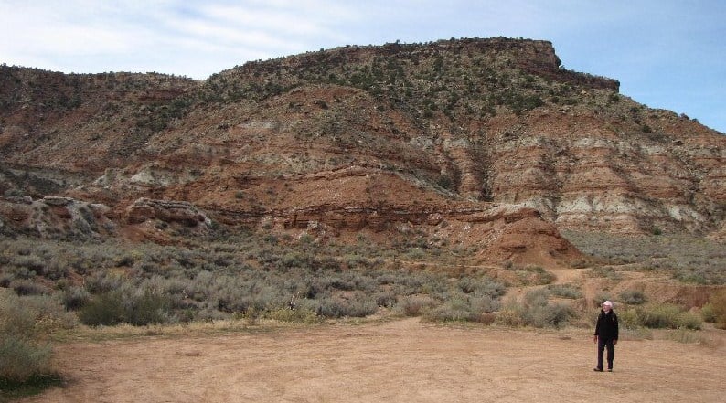
Moenkopi Formation of
Grafton Mesa |
We can see all this in the rocks of the Moenkopi Formation which outcrops all over southern Utah. A great place to get nose-close to the upper two members of this Formation, the Shnabkaib and the Upper Red, is along the trail to Grafton Mesa near Rockville and Zion National Park.
 |
| Gypsum of Shnabkaib member along Grafton Mesa trail |
 |
| White gypsum and red mudstone layers of Moenkopi Formation |
|
|
|
In the lower Shnabkaib member, gypsum was deposited in a “sabkha” or salt flat environment from evaporation of ocean or marine waters. The Upper Red consists of siltstone, mudstone, and sandstone deposited in arid tidal flats and coastal plains. Eventually, around 220 million years ago the environment changed to continental sediments of shallow interconnected braided streams. These streams drained into Utah from highlands of what would one day become Texas. We can see this in the sandstones and conglomerates of cliffs overlying the Moenkopi.
 |
| Contact between Moenkopi and overlying cliffs |
 |
| Gypsum beds |
It should come as no surprise that when I hike these days I stop pretty much every few feet to look at the rocks. Friends who hike with me are used to this; they will listen patiently as I blather on about sea level advances and retreats and the roundness of quartzite pebbles in conglomerates. Since we are not intent on breaking any land-speed records anyway, a three-mile round trip hike to the top of Grafton Mesa and back can take six hours if we are lucky!
 |
| Judy perched on a conglomerate towards the top of Grafton Mesa |
 |
| Moenkopi Formation in foreground; Navajo Sandstone cliffs of Zion NP in distance |
 |
| Petrified wood fragments scattered in quartzite pebbles on top of Grafton Mesa |
 |
| Lichen on sandstone |


