Day One
Somehow I was really lucky, once again. After a Katmai summer of rain and clouds and generally dreary weather, and several unsuccessful attempts to backpack out to the Valley of Ten Thousands Smokes, I finally was able to reach my goal of hiking up the Valley and reaching Novarupta. On the last possible backpacking weekend of the 2010 season the volcano gods and goddesses (and weather nymphs) saw fit to honor us with a ripping high-pressure system over the entire Alaska Peninsula (and as I write this on 9/18 the system is into its ninth day). I haven’t seen so much clear sky since I left Utah in late April.
Apparently Jeanette took it to heart that I had “Things left unfinished” since just a couple weeks earlier it looked like this geo-traveler might not get out to Novarupta, the site of the world’s largest volcanic eruption of the 20th century. So we put together a 2-night, 3-day backpack trip and were determined to go. Jeanette had been out there a couple weeks previous and knew the river crossings and where to get water. We would take whatever came along be it cold or wind or rain or all three. We really never expected to have glorious sunshine the entire time we were out. But there you go… We didn’t expect anything and got the best we could possibly get. It just goes to show.
After work last Friday 9/10 we got a ride out to the Three Forks visitor center, site of the melted pants. Robert, a Student Conservation Association volunteer working on a soundscape project, was also able to join us. We played some cards and each won a game. What an equitable party this was turning out to be! The plan was to head out early the next day.
It must have been around 3 or 4 in the morning on that moonless night when I woke up and stepped outside onto the porch. It wasn’t particularly cold, maybe in the low 40’s. There were no clouds. I looked up and stared at the sky, counting 1.7 billion stars at least – I know I must have missed a few, though. I just stood there gazing up, trying to take it all in. I found the North Star at this 58 degrees north latitude, and saw the few constellations I recognized (Cassiopeia, Orion, the Big and Little Dippers). The Milky Way seemed to take up half the sky. I was in awe, wondering “What is out there???” I have seen some pretty spectacular night skies in the southwestern US but nothing ever compared to this. I was unable to see any northern lights this far south – solar activity has been somewhat low lately and you had to be at least near the latitude of Fairbanks to view them. But I was not disappointed since the night sky itself was all I really needed to see. Northern lights would have been the icing on a chocolate truffle-filled cupcake of a night sky.
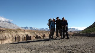
The next day (Saturday 9/11) we headed out early on the Windy Creek trail, our packs as light as we could make them. No cute little boxes of wine this time (although the next day we would wish we had brought some, of course)! The Windy Creek trail took us off the low mountain on which the visitor center is situated (the mountain is actually a terminal moraine, remnant of the last glacier to recede from the western Valley somewhere around 10,000 years ago). After walking for about an hour we were at the creek. At the 2 creek/river crossings in the Valley (Windy and Lethe) it’s best to exchange boots for sandals, since the water is generally at least knee deep, the current flows fast, and there aren’t any rocks to hop. This is glacial meltwater! Windy Creek flows clear but, as we knew, further into the Valley the River Lethe does not.
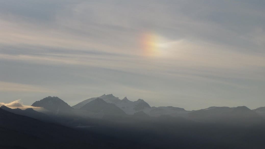
It was a glorious day! We couldn’t believe our good fortune with the sunshine. The rainbow prism we saw in the sky over Mt. Katmai this morning gave us all a good feeling about the weekend’s weather.
 Six Mile Campsite
We walked and walked and talked and talked. We stopped to snack after about 4 and ½ miles, and filled our water bottles with snow-melt cascading off the Buttress Range at the 6-mile campsite. We didn’t treat it but just filtered it through Jeanette’s bandanna to get rid of any silt. The Valley is wide open so we could see all the way to Broken Mtn., and then as we rounded a curve in the trail at the base of the Buttress Range we lost sight of Three Forks behind us and Baked Mtn. came into view ahead. This was our goal – the USGS research hut is located halfway up Baked Mtn. We would spend our 2 nights in the dusty shelter of its plywood walls. At the 6-mile campsite, if you are heading out into the Valley, you merely pull away from the Buttress Range and just head in the direction of whichever mountain is your goal.
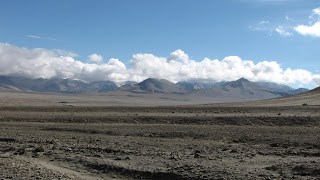
Baked and Broken Mtns.
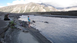
Preparing to Cross River Lethe
River Lethe has an ominous sound to its name. I think that was the intent when it was named back in the early days of exploration after the volcanic explosion. There are 2 choices to consider when crossing the Lethe – a narrow “jump spot” over a deep canyon in the ash, or a wider, shallower braided area where the water is silty and the current is fast and you use your hiking poles to probe the river bed before you step. We checked out the jump spot first. I was ok with the width but there was a vague discomfort level I just could not overcome. One misstep and I’d be toast. So we (mostly me but Jeanette and Robert would go with my decision) opted to cross at the wider braided area upstream. This crossing in itself is not a walk in the park either, by any means, but I felt more at ease here and so it was a go. We did fine, keeping a wide “John Wayne” stance and taking small steps. I celebrated by having a snickers bar on the other side.
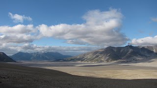
View Back Down VTTS
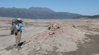
After crossing the Lethe it is definitely a long pull up the Valley to Baked Mtn; even though the elevation gain is gradual you still are going UP. It is a long view, too; it must be at least 2-3 more miles from the Lethe crossing, and you can see pretty much every inch of those miles. Baked Mountain OVER THERE would take us several hours to reach. I took just a few pictures because I wanted to reach my goal as quickly as my boots would carry me. The Valley floor is like a desert pavement in most places – the fine-grained silt and ash particles are easily blown up and away, leaving the coarser sand and gravels. There are fossil fumaroles or steam vents everywhere on the Valley floor – large and small areas of orange-brown-yellow-pink-stained sandstone and lithified ash that preserve the color of whatever minerals were present in that ash and also in the groundwater when the 2000°F pyroclastic flow blasted its way down the Valley during the explosion of Novarupta in June 1912.
Walking became slightly more difficult as we started up the steeper slope of Baked Mtn. The slope is soft, ashy sandstone and there isn’t much vegetation or soil formation to stabilize anything. Nearing the hut we had a choice of straight up or not-quite straight up the slope! So we chose straight up and switch-backed our way, sliding sideways with every step along the soft slope towards the hut which had not come into our field of view during the entire hike.
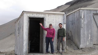
USGS Research Hut on Baked Mtn

After cresting a hill we were there! We had reached the USGS research hut on Baked Mtn. It had taken us all of 8 hours, my 20-something hiking buddies Jeanette and Robert hanging all the while with this old girl. All six of our feet were achingly tired and the first thing we did was take off our boots and put on sandals. We had arrived. It was absolutely worth the effort. And the sun was still shining.
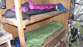
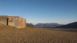
Room with a View
That evening we heated water on a small Jet-Boil stove we had borrowed, cooked and shared dinner contributions of couscous, dehydrated stew, and scotcheroos, went outside to watch the sunset behind the mountains, and, in the light of our headlamps and using a crate for a table, played some cards again in which each of us won a game.
Day Two
We arose for a breakfast of oatmeal (with added trail mix) and tea – isn’t that the standard trail breakfast for those who travel light, who don’t bring a skillet, bacon, eggs, pancake mix, and coffee?

Mt Griggs and hut
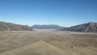
View from Ridge above Hut
We put together lunches and were soon ready to pay our tribute to Novarupta. Jeanette thought it might be nice to hike up the ridge from the hut to the top of Baked Mtn. for whatever incredible views were there. She thought she might be able to get a better view than from the saddle between Baked and Broken Mtns., the usual route to the vent. I was not sure I’d make it to the top – it looked pretty sketchy to me, with its sheer cliffs and steep slopes of shale and ash. But I’d go as far as I could for a view. It didn’t take me long, however, to figure out I would NOT be making the ascent to the summit, so I decided to return to the hut and take the low route between Baked and Broken Mtns. Jeanette and Robert (I made sure she didn’t go alone) would continue on the route at or near the top, and if it looked as sketchy to them as it did to me, they would turn back and follow my same route to the saddle overlooking Novarupta.
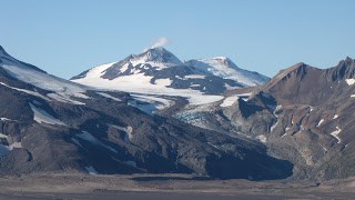
Mt. Martin steaming above Mageik glacier

Hike to the Saddle
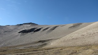
Baked Mtn Ridge
It took me about an hour to walk up the valley to the saddle. Now and then I could see Jeanette and Robert as tiny specks on the horizon of the ridge. I kept on, up and down the ridges and swales of the eroded valley floor. It was easy to pick a route through the ups and downs – again, I could see all the way to the saddle and just walked in that direction. Eventually the steepness increased as I walked up the slope of the saddle, still in ashy sand. There was a bit more scrubby vegetation here than in the Valley proper and so it was nicknamed “the lawn.”
At the top of the saddle I paused before looking over. WOW!!! Sitting there nestled below the peaks of Trident volcano and Falling Mountain with Mt. Mageik off in the distance was Novarupta itself, steam curls rising from the center of its plug of dark rhyolite lava. It is 1200 feet in diameter and 400 feet high – a tiny pimple on the landscape of the surrounding mountains but a giant among them. I was alone – Jeanette and Robert had not come down yet – and so I stood there and looked around at the scene before my eyes. I moved up the saddle 30 or 40 feet to a flattish spot with even better views, and sat down for lunch. I took a panoramic video, back and forth and back and forth. I could see the jagged peaks of Mt. Katmai in the distance behind Broken Mtn. but my eyes kept returning to Novarupta in the haze.
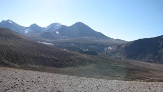
Novarupta Vent (center of photo) from Saddle

Novarupta Vent
Flat Stanley had come all this way for the view, too.
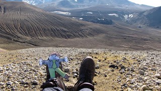
Soon I saw Jeanette and Robert coming up the valley towards the saddle – their route up Baked Mtn. had been quite sketchy and so they’d come all the way down past the huts and taken the route up the valley. The slope from the saddle down to Novarupta was pretty steep and would be a real trial to get back up, but I had come too far to stop now! OK then, off we went, Jeanette and Robert running while I gingerly picked my way down. It was probably a mile or so at most to reach Novarupta from the saddle.

Robert and Jeanette on the Saddle; Mt Katmai in distance
Being there was really sweet. I didn’t climb to the top – really loose volcanic rubble is not particularly my favorite hiking surface, so I was content to stay at the base investigating the mineral discolorations in the rock. Robert “Novarupta Ninja Climber” Finer scrambled to the top and disappeared over the steaming rim for a few minutes and then made his way back down. Jeanette “Novarupta Tour Guide to the Stars” Meleen didn’t go with Robert – she had climbed up on a previous trip.
When Jeanette and Robert went in search of a stream near “Baby Novarupta,” (there are many small volcanic vents near the base of nearby Falling Mtn) I stayed back; I would meet up with them as they passed below the vent on their way back to the saddle. I enjoyed just sitting and watching two lone hikers pass into the Valley without seeing me. I noticed how Falling Mtn. must surely have been blown apart by the blast of the eruption since one entire side of it is gone and it is in such proximity to the vent. Parts of Baked Mtn. had also been blown apart by the blast which was 10 times bigger than Mt. St. Helens on 1980.

Me At Novarupta
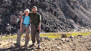
Hiking buddies Jeanette and Robert
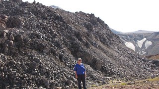
“Novarupta Nina”

Baked Mtn seen from Novarupta
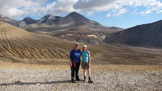
Nina, Jeanette, and Novarupta from the saddle; Trident volcano in distance
Soon it was time to go. Jeanette and Robert were all down (the old “up”) with exploring but this old girl needed that energy for the climb back up the slope to the saddle. I figured it would take me at least an hour of slipping sideways through the sandy ash. I found that I at least had forward momentum as we zig-zagged up so that was great! Finally we were at the saddle, and we took a break and some final pictures of Novarupta and Mt. Mageik in the late afternoon sun. It was smooth hiking from there back to the hut, and it was then that we thought how nice a glass (or plastic cup) of wine would have been, to celebrate our accomplishment. We also played cards again later after dinner and each of us won a game for the third night in a row.
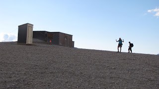
Back at the hut
Earlier, I had gushed on effusively about the night sky, and so we sat out on the ridge above the hut, watching the sunset turn to dusk and then darkness along the mountains and Valley. The stars came out one by one and then BOOM!!! There they all were, with the Milky Way stretching its arms across the sky from Mt. Griggs on one side of the Valley to Mt. Mageik on the other. Again I got up in the middle of the night to look at the sky and the stars once more, marveling at the immensity of it all. And I again wondered what is out there, all those millions of light-years away.
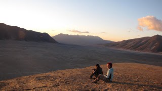
Watching the sun set

Moon setting over steaming Mt Martin
Day Three
The next morning it was time to leave, but we were not sad because our time at Novarupta and the Valley of 10,000 Smokes was over. We rejoiced that it had happened.

So we had our breakfast of oatmeal, trail mix, and tea, cleaned up, shouldered our packs, and headed down the Valley, reversing the route we had taken 2 days before. We made good time going downhill and reached River Lethe in half the time it took to get from there to the hut.
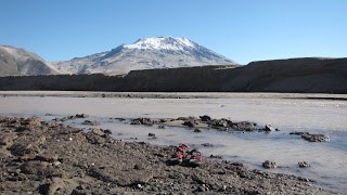
We forded without difficulty, had a snickers bar, and took our time moving across the Valley, bypassing 6-mile campsite for water at 5-mile which is closer to the trail. We stopped to investigate fumaroles and took more pictures of each other.
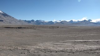
View across the Valley
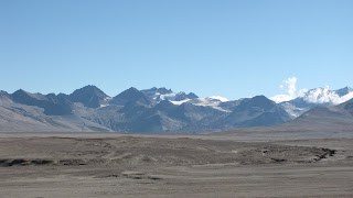
Mt Katmai and Knife Creek glacier
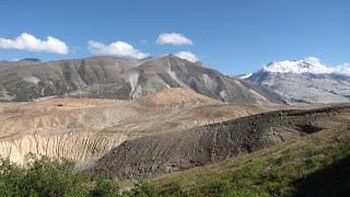
Taking a look down the Lethe from an ash hill
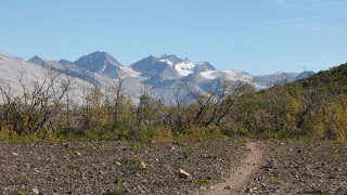
Early Autumn in the Valley of 10,000 Smokes
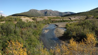
Windy Creek
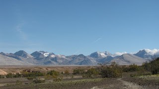
Mt Katmai in distance on left
There was a soft breeze blowing from up-canyon, just enough of a tailwind to scoot us along our path back towards home. “Get along, little rangers” the wind seemed to be saying. “It’s time to go.” Windy Creek felt wonderfully cool on my hot tired feet and I could have walked the entire 2 miles back to Three Forks in its clear water. As with the entire trip, Mt. Katmai stood cloudless in the distance, watching over our little troupe of hikers.
I myself felt a real sense of accomplishment, knowing that if getting to Novarupta were easy, everyone would do it. And I thank my lucky Alaska night sky stars that I could and did.
