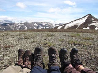
tundra A treeless, level or gently undulating plain characteristic of arctic and subarctic regions. It usually has a marshy surface which supports a growth of mosses, lichens, and numerous low shrubs and is underlain by a dark, mucky soil and permafrost.
Having been in Alaska for all of two months now (and barely even that, since I arrived in Anchorage on April 26), I have found that it is best to accept graciously what is offered and run with it, especially where the weather is concerned. If, for instance, you set out for a day hike or backpack or canoe trip and it’s raining while you are putting your gear together, you still go. High winds would be the most delaying factor in any water endeavor, but rain… well, rain is a given and is definitely part of the package here in the 49th state. You just deal with it and savor the fact that you are here in the first place. You plan a hike for your day off from work with a couple of co-workers, thinking that it will probably be just cloudy at best and that the views you look forward to seeing will most likely be at least partially if not totally obscured by a low-hanging ceiling of gray drizzly dampness. In Alaska, there are no guarantees that everything will go as you’d hoped and that you will have perfect weather. If you wait for it to stop raining you could be waiting for a long time. We are not in Utah anymore, Toto.
But every so often you luck out. The volcano gods and goddesses shine their light on you and offer to you what you had no right to even begin to hope for or especially to expect – a clear, nearly cloudless sunshine-bright Sunday on which to see unnamed mountains you might not have known existed, beyond what you might have ever hoped to see, on the day before the summer solstice in southwest Alaska.
On the road to the Valley of Ten Thousand Smokes is a long low bread loaf-shape of a mountain called Solstice Ridge. I thought how appropriately named this hike would be for my Sunday off on June 20th. As mountains go, the ridge line is not really that high, somewhere around 3000 feet above sea level. Brooks Camp is around 40-60 feet above sea level and the “trailhead” (I am being very kind here – actually it would be merely where we parked the car) is around 1000 feet. Many of the low mountains in Katmai have been so scoured by the passage of the glaciers that they take on this bread-loaf appearance, their previous jaggedness all but disappeared, eventually becoming a tundra environment.
The ridge-top looked attainable, and folks said it was one of the easier hikes in the area. There would be no trail, of course (Katmai has so few maintained trails in all of its nearly 5 million acres) and we would need to pick and choose our own ascent route “on the fly” in order to attain the ridgeline. How difficult could that be?
So with Jeanette driving the Excursion and Jacqui contributing such iPod favorites as Iron & Wine, Animal Collective, and Zap Mama, we left the mosquitoes at the maintenance shed and headed down the 23-mile road past the three river crossings and onto the VTTS. It was a gorgeous morning – first of all we had the day off, second of all it was not raining, and third of all it wasn’t even cloudy! We could not believe our luck. There was hardly a cloud in the sky as we drove out of the spruce forest and into the open tundra.
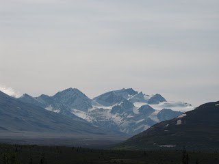 Mt. Katmai from VTTS road
And then it appeared on the distant horizon – the jagged peak of Mt. Katmai, its caldera hidden beneath its serrated rim. People can go years without seeing Mt. Katmai since it is most often obscured by clouds. How fortunate we were! I of course had to stop the car, compose my photos, and drink in the scene. This absolutely made up for all those lost pix on my now-defunct external hard drive.
We parked the car and trundled off across the tundra for maybe a mile towards Solstice Ridge. Our plan was to avoid the alder as much as possible (worse than manzanita and scrub oak!) and switch-back our way up one side to the top. Before long we also had to avoid a bear that we noticed was toodling down the creek in our direction. Oh fine! We made a course correction and soon (very!) we were pointing our little heads straight up the side of the ridge.
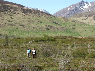 Jeanette and Jacqui before the ascent
Two hours into the hike and I was cussing a blue streak, ready to give up and go home. The mosquitoes weren’t even bothering me – I was that busy cussing. The tundra grasses were a total disaster – knee deep in the good places, sunk up to my thighs in many a hidden hole, there was no sure footing whatever, it was soggy, mushy, horrible, I was doing hand over hand (in grass of all things!) towards the top, and I never did find my rhythm. To look at that ridge from the bottom, I would never have known it would be that miserable. I sure know it now.
But I made it! I could not quit! With sheer determination (and not wanting to go back where the bear was) I pulled myself up that soggy, mushy, bleeping alder and grass of a slope to where Jacqui and Jeanette had been waiting for me (not THAT long, actually). Woo Hoo!!!
 On top at last
And then it really WAS a piece of cake.
 Lunch view of Dumpling Mtn.
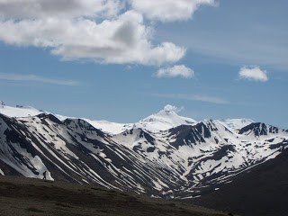
The views were forever. We hooted and hollered our way for probably 2 miles or more along that wide ridge, soaking up every snow-covered mountain peak and glacial u-shaped valley we saw. Griggs, Katmai, Trident, Mageik, and Martin (complete with its steam plume) were all there waiting for our arrival on Solstice. We could see past the Ukak to the Savonoski River. 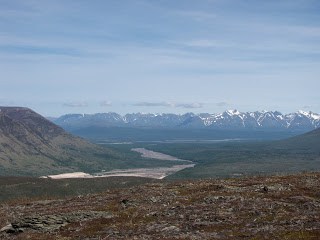
The VTTS was the ashen thread holding it all in place. Jacqui and Jeanette warbled a sweet Happy Birthday! We took pictures of each other jumping into the air. The backdrop for our lunch break was Dumpling Mountain, the Iliak Arm, and Naknek Lake far off in the distance. We could not believe it. We felt so honored to be in that time and place. This is what I came to Alaska for.
Would I do it again?
For those views?
In a minute.
